Application Description
If you're looking for a seamless way to manage your KML/KMZ/GPX files, explore GIS functionalities, measure distances, log GPS data, utilize WMS, or download offline maps, look no further than Mapinr. This app offers a comprehensive solution for all these needs, and we're committed to keeping it alive despite the rapid evolution of Android versions. As a non-profit project, our goal is to provide a secure, privacy-friendly, and affordable app that caters to everyone.
We understand that the latest Android versions might not be compatible with every device. That's why we continue to offer downloads for versions below Android 14 on our website, ensuring that no one is left behind due to the Play Store's limitations.
Are you interested in managing your personal points of interest or mapping your photos? MAPinr is the perfect solution. This ad-free Android app is designed for both professional and recreational use, whether you're into hiking, cycling, running, skiing, or any other outdoor activity.
We value your feedback and ideas for improving MAPinr. Please share your thoughts and suggestions via email at [email protected]. We appreciate constructive criticism and understand that software bugs can be frustrating. Our limited resources mean we can't implement every suggestion, but your patience and understanding are invaluable.
MAPinr offers a wide range of functionalities, including:
- Ad-free Experience: No interruptions from ads.
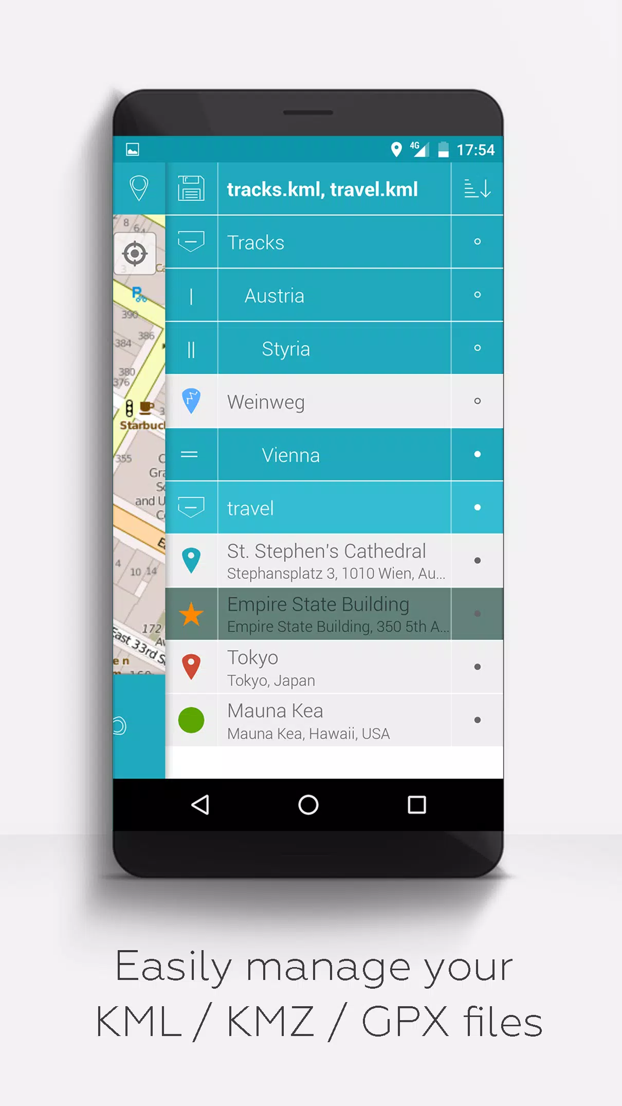
- Organized File Management: A hierarchical folder structure for managing multiple KML/KMZ/GPX files.
- Comprehensive KML/KMZ Management: Create, load, edit, save, import, export, and share KML/KMZ files.
- Waypoints, Lines/Tracks, and Polygons: Create, load, edit, save, import, export, and share these elements.
- Photomaps: Add pictures to your waypoints to create personalized photomaps.
- Versatile Map Display: Display your data on various maps, including Maps, Satellite, Hybrid, OpenStreetMap, Opentopomap, and Opencyclemap.
- Coordinate Sharing: Easily share the coordinates of your waypoints.
- Customizable Visuals: Individually colorize waypoints, lines/tracks, and polygons.
- Interoperability: Open exported KML/KMZ files in other apps.
- Advanced Search: Search by name, address, and coordinates.
- Location Sharing: Let your friends know where you are in real-time.
- Multi-File Support: Display multiple KML/KMZ/GPX files simultaneously.
- File Merging: Merge KML/KMZ files as needed.
- Cloud Integration: Seamlessly integrate with cloud services.
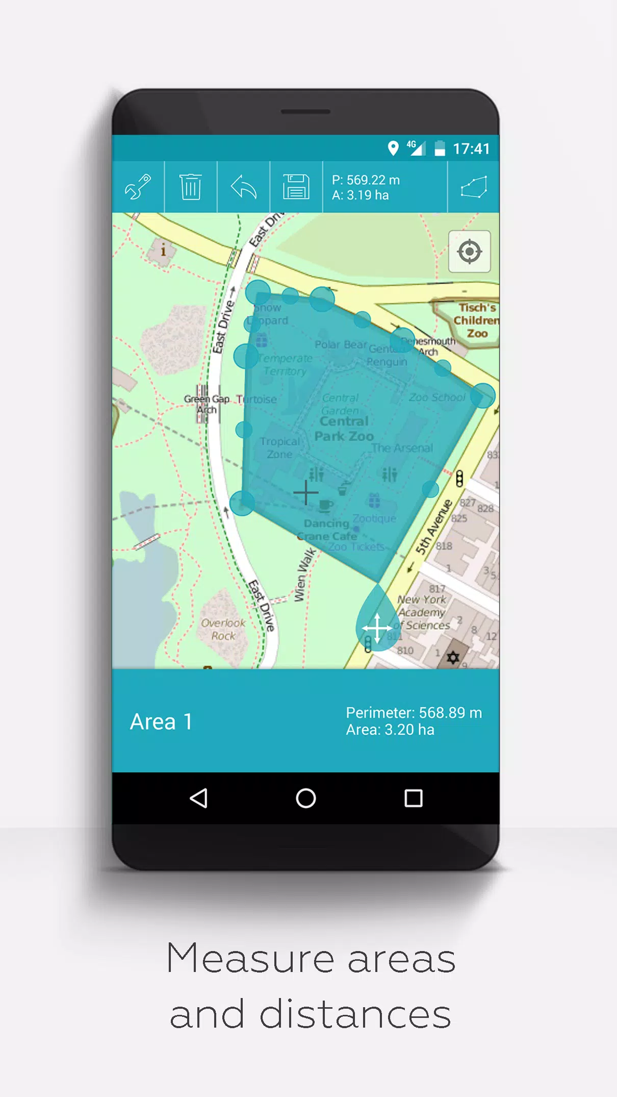
- Measurement Tools: Measure distances and areas directly on the map.
- Multilingual Support: Currently available in English, Spanish, Lithuanian, and Polish.
For those who wish to unlock extended features, you can do so with donations or by liking us on LinkedIn. These features include:
- Offline Maps: Download OpenStreetMap for free.
- GPX Viewer: View GPX files without limitations.
- WMS Support: Display arbitrary map data using Web Map Service, such as Opendata from www.data.gov.
- Custom Metadata: Create custom metadata for your maps.
- Custom Icons: Upload and use your own icons.
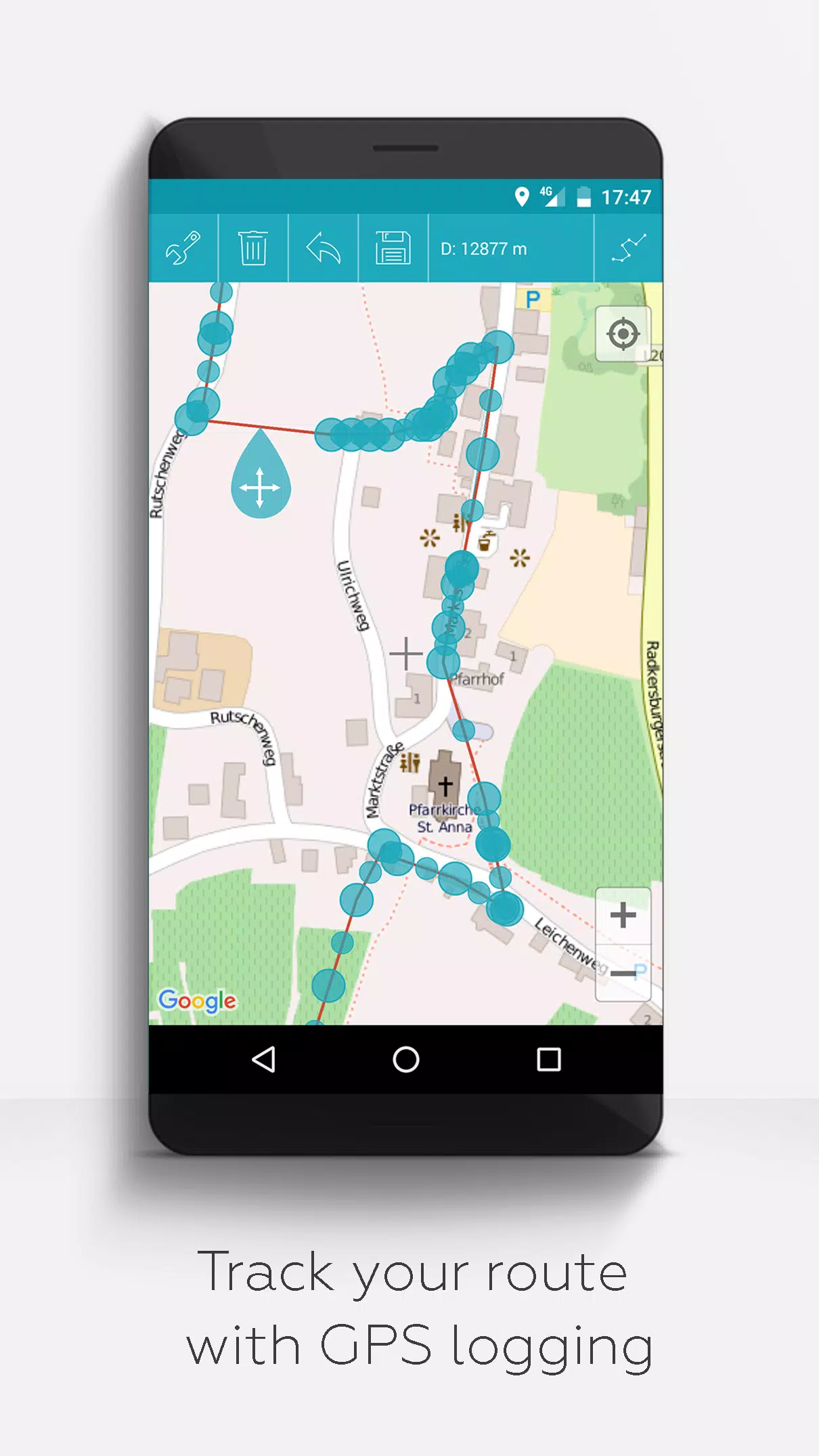
- GPS Logging: Record GPS tracks for your journeys.
Compared to other apps, MAPinr prioritizes your privacy and does not engage in data sniffing or selling. Donations are a voluntary way to support our non-profit efforts, and we are grateful for any contributions that help us continue our mission.
Travel & Local


 Apps like MAPinr - KML/KMZ/OFFLINE/GIS